The first built-in automotive navigation system required a regular paper roll change
One city on one cassette – how the evolution of digital navigation started
The story of automotive “navigation” started with a classic folded car map in the glove compartment – nowadays, almost every smartphone has a satellite navigation system, therefore map folding is a strange concept for the younger generation. Since the invention of the internal combustion engine, traffic has accelerated and changed scale, which resulted more and more active traveller needing support during their journey with an answer to the question: “Where should I go?”
Real-time navigation before GPS
Even before GPS-based navigation options became available, there were attempts to show in real time where are we on the map. In the 1930s, the Italian Iter Avto introduced its first in-vehicle system, which, of course, was not yet GPS-based. The device was positioned on the dashboard of a car and came with a glass-covered paper map. The map sheets were produced in roll formats that had to be selected and threaded by the driver before departure. The device was connected to the speedometer, so the scroll rate was in proportion to the travel speed. If drivers strayed from their route or arrived at a bigger crossroad, they would have to load a new map based on the junction number.
The next major milestone was the Electro Gyro-Cator, developed by Honda in the 1980s. Since the GPS system was only available to the U.S. military around that time, they created a gyroscopic system. Map sheets were tailor-made to this system and had to be inserted onto a monochrome screen. Drivers were able to see the current position of the vehicle due to the gyroscope detecting turns and the distance covered.
A whole city on three cassettes
We entered the digital age in 1985 with the release of Etak Navigator. The now digital data was stored on tape cassettes; a map of a larger city could fit on three or four of them. The system calculated the location of the vehicle by relative positioning. A compass, an on-board computer, and a wheel tachometer with a magnetic sensor were used for this.
Toyota introduced the Crown Royal Saloon G model in 1987, which had the world’s first CD-based car navigation system – with a colour screen! – built in it.
In 2000, President Clinton announced the abolition of the Selective Availability (SA) signal, which affects the accuracy of the GPS system, and this paved the way for the rapid development of civil navigation systems. In the databases of navigation systems, coordinate data, topological relations of the elements, and various descriptive data (e.g., street names, traffic directions) are recorded as metric information.
From static maps to searchability
With the coming of the digital age, the map turned into a database and after the involvement of traffic information, it became dynamic as well. At the beginning, maps could only be viewed on static websites without interactivity. Next to the static approach, the need for the searchability of various services and places appeared very soon.
In order to meet user demand, MapQuest created its free online map service in 1999, which could be enhanced and moved. Its popularity declined after the release and expansion of Google Maps in 2005. The next big breakthrough were the personal digital assistants, known as PDAs. These devices were able to display an enhanced map on the vehicle, manage their updates and give instructions to the driver on-the-go thanks to the navigation application.
The NNG-developed iGO started its world conquest in 2005 – at that time, without internet connection. An interesting data that reflects the development of the industry: the entire map of Europe was 1 GB in 2006, of which Hungary took 15 MB of space on the car’s SD card. Today, Hungary occupies 300 MB and Europe 28 GB.
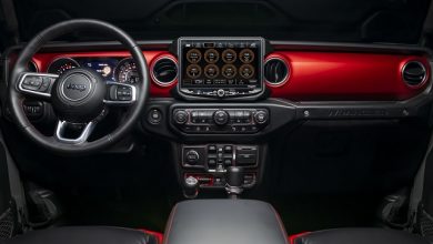
Internet has become available to almost everyone and everywhere, eliminating the need to update maps with a PC program, as now it is possible to do it online. Smartphones and constant internet access have brought the advancement of online applications. 4G and the more and more widely available 5G are providing instant information transfer to navigation technologies. Nowadays, car navigation devices are one of the basic elements of driving, from smartphone services to factory-installed car infotainment systems – a significant part of which is developed by NNG.
On the way to self-navigation
Right now, navigation systems give instructions to the driver, but in the not-too-distant future, they will be able to give similar instructions to the Drive-By-Wire electro-mechanical system. For this system to work, high-definition (HD) data and a sensor-built environmental model built is needed. Because in navigation, it is not the 3D view seen by the driver (topography, realistic view of buildings, etc.) what is the most relevant, but the detailed database content, which allows cars equipped with a suitable device to control their speed and stay on the traffic lane more efficiently – they can even operate the headlights. HD data is usually only available online, via stream, as the amount of data is too large and changes too fast (currently in every day, but soon in every three hour). The map doesn’t change at this rate everywhere, but it is important that when a change happens, it gets into the car quickly: the industry has moved from the traditional quarterly update to the present situation, but the ultimate goal is the Connected Car System: the map that updates in real time while you drive.


